Seismic activity in Santorini: a lesson of earthquake monitoring and resilience
The Greek island of Santorini, renowned for its very beautiful caldera and volcanic past, has seen the most energetic seismic activity recently. Over 2,500 tremors reported since early January hint at some pending big seismic event. For the last year, local and international teams monitored the authorities while recently deploying new underwater seismographs to get a reading about volcanic activity there at the submarine volcano called Kolumbo. Beyond the immediate response, however, it provides some useful lessons regarding how modern seismology does its work in studying and preparing for such events.
Understanding the Santorini seismic sequence
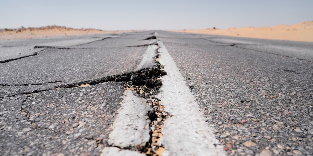
The geological history of Santorini is basically linked to its volcanic and tectonic setting. The very island itself constitutes what was left of one of the biggest, if not the biggest, eruptions in historical times, around 1600 BCE. Thus, the existing seismicity of today is basically expected, bearing in mind that this region corresponds to the most seismically active area of Europe, if not globally- the Hellenic Arc. Scientists have been studying the nature of these tremors to determine whether they reflect purely tectonic activity or the movement of magma beneath the island. The reaction to seismicity from Santorini reflects a quantum leap in earthquake monitoring. Whereas a few decades ago, data were limited to land-based seismometers, today, scientists are employing an array of sophisticated tools.
Underwater seismographs record the deep-sea tremors and possible movements of magma chambers. Special instruments are placed on the ocean floor to monitor seismic activities under the sea around the clock. Real-time data helps scientists study the pattern of underwater earthquakes and determine whether these tremors indicate magma movement. This method is, therefore, very important for early warnings related to potential underwater eruptions due to Santorini’s proximity to the submarine Kolumbo volcano.
In particular, satellite geodesy has dramatically changed the ways in which InSAR is used to monitor ground deformation. For example, minute changes in the land elevation over time, resulting from underground magma intrusion, could be detected with the analysis of satellite imagery. It gives an enlarged view in space and hence permits continuous surveillance of extensive ground areas that often cannot be visited in the field. InSAR technology, in the case of Santorini, comes in handy to monitor how the ground is reacting to this ongoing seismic activity uplift or subsidence that might signal an imminent volcanic event.
Artificial intelligence is finding more and more applications in seismic research. AI-crown predictive models analyze large volumes of seismic data for patterns that may go undetected by traditional methods. Seismic swarms, through machine learning algorithms, can be classified as ordinary or ones that have grown into major earthquakes or eruptions. With historical data combined with current seismic readings, AI further enhances the precision of predictions and quick decision-making. As such, AI systems keep evolving, so they will be handy in issuing an early warning against earthquakes and volcano-prone areas like Santorini. These techniques are especially important for a region such as Santorini, where seismicity is very complicated and interlinked with volcanic hazards.
Global lessons from Santorini
The ongoing situation in Santorini serves as a case study for earthquake and volcano monitoring worldwide. Similar regions, such as Iceland and Indonesia, have benefited from multi-disciplinary approaches to seismic research. Iceland, for instance, has successfully used GPS and real-time data analysis to predict and mitigate volcanic eruptions, while Indonesia has integrated community-based disaster preparedness programs alongside scientific monitoring.
For Santorini, the current crisis reinforces the need for long-term monitoring, data sharing, and public preparedness. Earthquake swarms, even if they do not result in a major eruption, provide valuable data that can improve early warning systems globally.
Authorities in Santorini urge calm while scientific teams continue their investigations. The deployment of international research teams to study the region is a testament to the importance of collaborative seismology in disaster risk reduction. As technology advances, so does our ability to predict, understand, and respond to natural phenomena that have shaped our planet for millions of years. The events in Santorini are not just a localized concern—they contribute to a broader understanding of earthquake and volcano monitoring that can protect lives and infrastructure on a global scale.